UPDATE 11:35 a.m.
Environment Canada has extended the special air quality alert to the Lower Mainland, Eastern Fraser Valley, and the majority of the Okanagan.
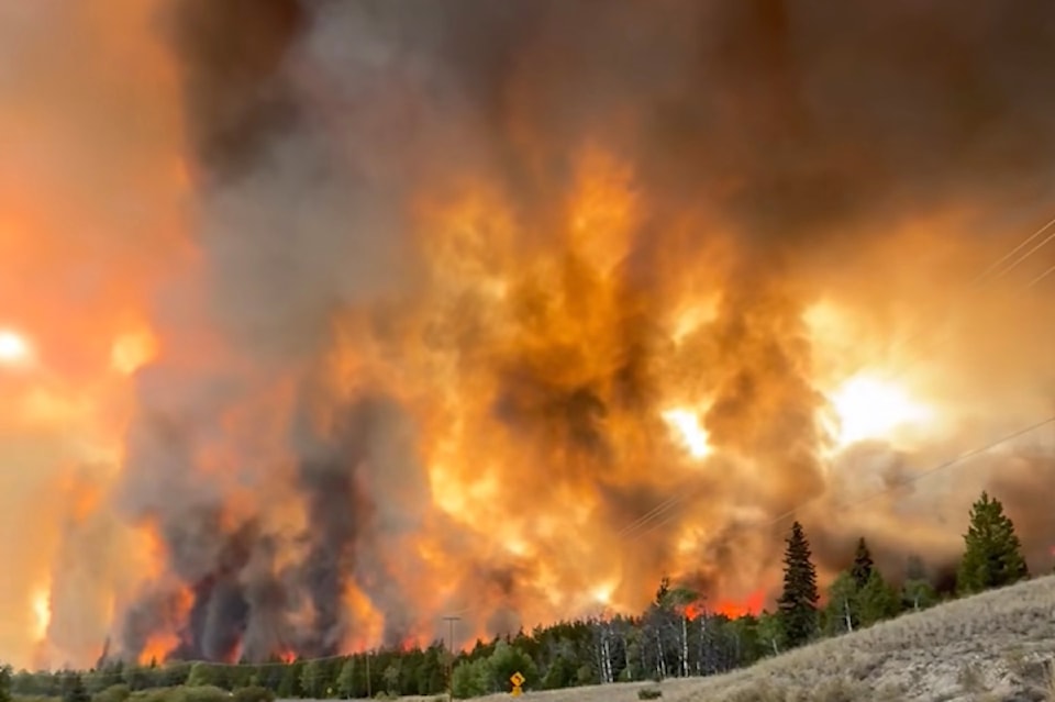
"Numerous regions across B.C. are being impacted or are likely to be impacted by wildfire smoke over the next 24-48 hours," said the government weather agency. "Smoke haze will be present across the majority of the B.C. landscape and can be highly variable."
In the Okanagan, the alert reaches east to Golden and south to Naramata. The South Okanagan, including Princeton has not been issued the alert at this time.
Poor air quality is also expected along the Coquihalla Highway and along Highway 3 from Hope to Manning Park.
The entirety of the Lower Mainland is under the alert, extending up the Sea-to-Sky Highway to Whistler and Pemberton.
Vancouver Island is not impacted by the weather statement at this time.
Original
High temperatures and wildfire smoke have forced Environment Canada to re-issue multiple weather alerts for the Cariboo and Northern B.C. regions.
Kamloops, Ashcroft, Lytton, and west to nearly Pemberton have been issued a heat warning, while Clinton to 108 Mile Ranch has both a heat warning and a special air quality statement.
In those areas, temperatures are expected to reach the mid-30s during the day with an overnight low of 14 C. The warmer temperatures are expected to continue throughout Thursday.
Along the province's coast, a heat warning is also in effect for Bella Coola and north up to Terrace.
"A ridge of high pressure anchored over B.C. is bringing very high temperatures to the region," stated Environment Canada. "A gradual cooling trend is expected by the weekend."
The special air quality statement is in place for a large portion of B.C., ranging from Clinton, throughout the Cariboo region including Williams Lake, Quesnel, and Prince George, west of Anahim Lake, up to Burns Lake, and along the B.C.-Alberta border including Chetwynd, Dawson Creek, Fort St. John, and Fort Nelson.
"Expect increasing smoke near new and active fires across the province," stated the government weather agency. "During a wildfire, smoke conditions can change quickly over short distances and can vary considerably hour-by-hour."
As smoke levels increase, health risks increase, according to Environment Canada.


